Township and Range - Alternate Grid.
A user account is not needed
for the features on this web page.
|
|
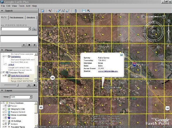
Click for larger image.
|
The USGS grid was scanned from a wall map. Good alternate if there is a gap
in the BLM data, but with less accuracy. Provides full coverage of all townships,
but does not have sections or quarter-quarter sections. Calculates area, centroid,
and corner points. You must zoom into the central or western United States
to see the data.
Hint
In mountainous areas it might be helpful to turn off the terrain layer in Google
Earth. Otherwise, the survey grid can look distorted as it shapes itself to
the earth's surface.
Information: USGS Township and Range
This data set portrays the Public Land Surveys of the United States, including areas
of private survey, Donation Land Claims, and Land Grants and Civil Colonies. This
is a revised version of the May, 2002 data set.
U.S. Geological Survey, 200301, Public Land Survey System of the United States:
U.S. Geological Survey, Reston, VA.
Link -
http://nationalatlas.gov/atlasftp.html
FAQ -
http://www.nationalatlas.gov/metadata/plss00p020.faq.html
USGS DISCLAIMER:
These data are intended for geographic display and analysis at the national level,
and for large regional areas. The data should be displayed and analyzed at Factors
appropriate for 1:2,000,000-Factor data. No responsibility is assumed by the U.S.
Geological Survey in the use of these data.